Electromagnetic Geophysics
Articles & Whitepapers
-
Electromagnetic (EMI) surveys
EMI (EM-34) surveyDesigned and performed an EM-34 soil conductivity (soil mapping) survey of a 26-acre wood-waste landfill in Omak, Washington. This soil mapping survey was designed to detect buried drums at a depth of 60 feet and was augmented by a total-field magnetometer survey. While employed with the Arkansas Department of Environmental Quality (ADEQ), performed approximately 40 ...
-
Geophysical applications to solid waste analysis
Abstract: Case studies of regional landfills show that electromagnetic geophysical methods can accurately and inexpensively define boundaries and thickness of waste. Degradation of putrescible solid ...
News
-
Study to Uncover Yellowstone’s Subsurface Mysteries
A new study providing an unprecedented regional view of the earth’s crust beneath Yellowstone National Park will begin with a helicopter electromagnetic and magnetic (HEM) survey on November 7, 2016. Scientists from the U.S. Geological Survey, ...
Equipment & Solutions
-
Showcase
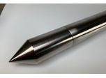
Magnetometer Cone
A magnetometer is a scientific instrument used to measure the strength and/or direction of the magnetic field. The Earth’s magnetic field (the so magnetosphere) varies from place to place, for various reasons such as inhomogeneity of rocks and the interaction between charged particles from the Sun and the magnetosphere. A mass of ferromagnetic material creates a detectable disturbance in ...


